The Environmental Hazard
Adaptation Atlas
Stanford University's ECHO Lab partnered with Hyperobjekt to track exposures and health outcomes from wildfire smoke and extreme temperatures.
Go to site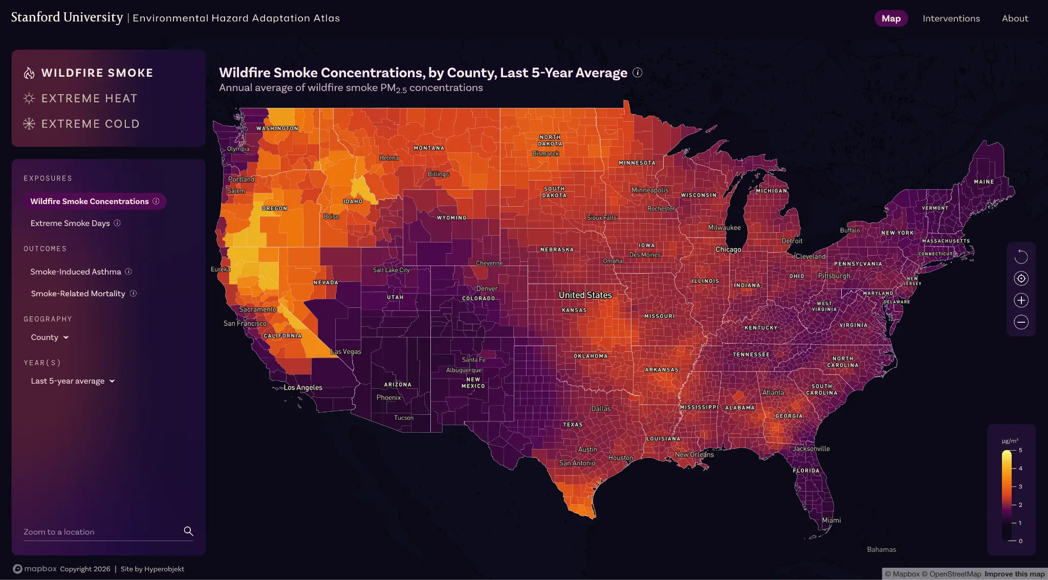
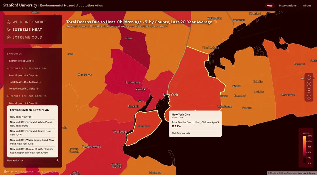
The Environmental Hazard Adaptation Atlas web application allows users to explore wildfire smoke and extreme temperature exposures for every county and Census tract in the United States for the last two decades.
Background
About the Client
The Environmental Change and Human Outcomes (ECHO) Lab conducts research on climate change's effects and adaptations. It focuses in particular on population exposures to wildfire smoke, the adverse health outcomes of these exposures, and the deepening impacts of a changing climate over time.
About the Project
The ECHO Lab’s groundbreaking research has estimated that by 2050, wildfire smoke will have been responsible for over two million additional deaths in the U.S., making it “one of America’s deadliest climate disasters,” according to coverage of the Lab’s work in The New York Times. The new Environmental Hazard Adaptation Atlas is a unique visual and interactive repository of wildfire smoke exposure data and related health outcomes, along with other hazards such as extreme heat and extreme cold events. The Atlas will be updated with new data from ECHO Lab, analysis of policy interventions to adapt to growing health threats, and new interactive features to extend its utility as the definitive resource on increasing climate risks.
Goals and challenges
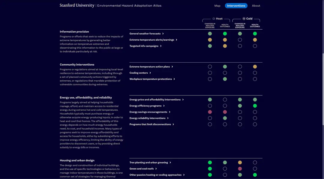
- Visualize decades of wildfire smoke, extreme heat, and extreme cold exposure data with a high degree of geographic fidelity – 3000+ counties and 85,000+ Census tracts
- Combine environmental hazard exposures and related health outcomes in a single interface
- Create an extensible design and user experience to enable future expansion with new years of data, more geographies, and a broader set of hazards including hurricanes and other extreme weather events
- Go beyond exposure and outcome measures to introduce users to policy-level interventions designed to mitigate climate change effects
Solutions and Features

Map-based interactive visualizations toggled by county or Census tract
Map-based interactive visualizations toggled by county or Census tract
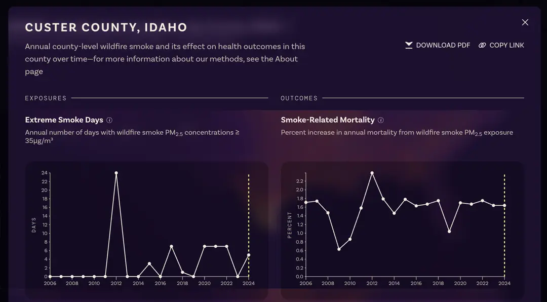
Profiles and data trends for over 88,000 individual counties and Census tracts
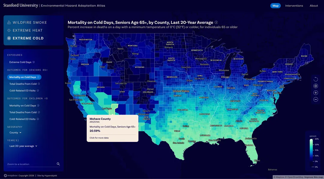
Three main environmental hazards – wildfire smoke, extreme heat, and extreme cold – with multiple exposure and health outcome measures for each
Analysis of the effectiveness of various mitigation strategies
Coverage and Impact
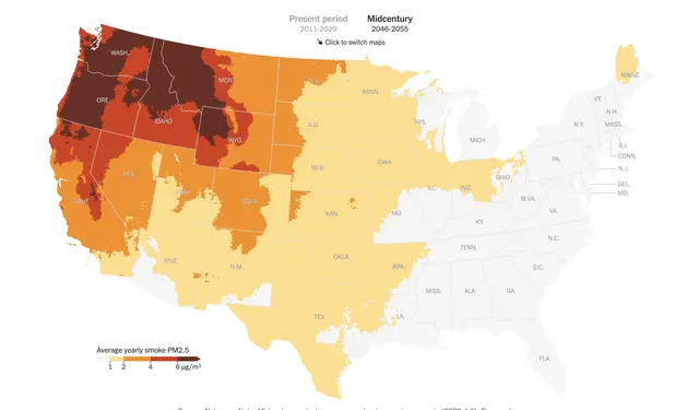 Pollution from fires, intensified by rising temperatures, is on track to become one of America’s deadliest climate disasters.
 As California sees an increasing amount of wildfires, researchers from Stanford University and a Northern California nonprofit are helping residents prepare for and manage their exposure to toxic wildfire smoke.
Interested in working with us?
Please use the contact form or write to us at info@hyperobjekt.com
